


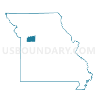
Corder Voting District, Lafayette County, Missouri
About
Outline

Summary
| Unique Area Identifier | 608921 |
| Name | Corder Voting District |
| County | Lafayette County |
| State | Missouri |
| Area (square miles) | 22.63 |
| Land Area (square miles) | 22.56 |
| Water Area (square miles) | 0.07 |
| % of Land Area | 99.70 |
| % of Water Area | 0.30 |
| Latitude of the Internal Point | 39.13047990 |
| Longtitude of the Internal Point | -93.63938120 |
Maps


Graphs
Select a template below for downloading or customizing gragh for Corder Voting District, Lafayette County, Missouri


Neighbors
Neighoring Voting District (by Name) Neighboring Voting District on the Map
- 1st Higginsville & W. Davis Voting District, Lafayette County, MO
- 2nd North Higginsville & 3rd & JKV Voting District, Lafayette County, MO
- Alma & E. Davis Voting District, Lafayette County, MO
- Dover Voting District, Lafayette County, MO
- Waverly 1st,2nd,East & West Voting District, Lafayette County, MO
Top 10 Neighboring County Subdivision (by Population) Neighboring County Subdivision on the Map
- Davis township, Lafayette County, MO (4,826)
- Dover township, Lafayette County, MO (2,204)
- Middleton township, Lafayette County, MO (1,606)
Top 10 Neighboring Place (by Population) Neighboring Place on the Map
Top 10 Neighboring Unified School District (by Population) Neighboring Unified School District on the Map
Top 10 Neighboring State Legislative District Lower Chamber (by Population) Neighboring State Legislative District Lower Chamber on the Map
Top 10 Neighboring State Legislative District Upper Chamber (by Population) Neighboring State Legislative District Upper Chamber on the Map
Top 10 Neighboring 111th Congressional District (by Population) Neighboring 111th Congressional District on the Map
Top 10 Neighboring Census Tract (by Population) Neighboring Census Tract on the Map
- Census Tract 904, Lafayette County, MO (6,794)
- Census Tract 902, Lafayette County, MO (5,829)
- Census Tract 903, Lafayette County, MO (1,517)